Nestled in New Mexico, the Sandia Mountains offer a plethora of hiking trails for all levels of adventurers.
This guide provides detailed descriptions of various hikes, covering difficulty levels, trail specifics, and essential tips.
Trails Overview
| Difficulty | Trails Covered | Miles | Maximum Elevation Difference (feet) |
|---|---|---|---|
| Moderate | Strip Mine Trail; Trail 246 | 6 | 1,580 |
| Moderate | Three Gun Spring Trail | 5 | 1,580 |
| Moderate | Hawk Watch Trail | 4 | 1,540 |
| Moderate | Del Agua Trail, Piedra Lisa Trail | 8 | 2,200 |
| Moderate | Piedra Lisa Trail, Rincon Spur Trail | 7 | 1,220 |
| Moderate | Ojo del Orno, North Crest Trail | 3.5 | 1,010 |
| Difficult | South Crest, Lower Faulty, Upper Faulty | 5.5 | 1,040 |
| Easy | Armijo Trail | 4 | 700 |
| Difficult | Embudo, Post Pass, Three Gun Spring, Whitewash Trails | 10 | 2,440 |
| Difficult | Pino Trail | 8 | 2,760 |
| Difficult | Embudito Trail | 11 | 3,540 |
| Difficult | South Crest Trail, CCC Trail | 10 | 2,840 |
| Difficult | Cienega, South Crest, Tree Spring, Oso Corredor, Sulphur Canyon Trails | 11 | 2,200 |
| Moderate | North Crest, Penasco Blanco, Osha Loop, 10K Trails | 9 | 2,150 |
| Moderate | North 10K Trail, Osha Loop Trail | 9 | 800 |
| Moderate | Crest Spur, South Crest Trail, Kiwanis Cabin | 7 | 1,180 |
| Most | Chimney Canyon Trail, La Luz Trail | 8 | 2,440 |
| Difficult | Osha Spring Trail | 8 | 2,500 |
| Moderate | Tramway Trail | 4.5 | 670 |
| Easiest | Boundary Loop Trail | 4 | 570 |
| Moderate | Agua Sarca Trail, North Crest Trail, Del Orno Trail | 7 | 2,500 |
| Moderate | Fletcher Trail | 5 | 1,040 |
| Difficult | Domingo Baca Trail, TWA Canyon | 7 | 2,280 |
| Moderate | North Mano Route, South Mano Route | 5 | 950 |
Moderate Trails
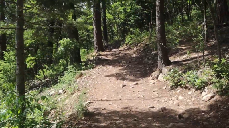
Strip Mine Trail and Trail 246
@hollyondish the abandoned ghost town was obliterated by strip mining operations & the black plague. cryptids & ghost sighting have been witnessed here. #appalachia #cryptid #DoritosDareToBeBurned #OLAFLEX #fyp #pennsylvania #paranormal #abandoned #fypシ #570 #abandoned #folklore #urbex #haunted
Driving Instructions
Take I-25 north from Albuquerque, exit at Placitas (exit 242), and head east. After 3 miles, turn right on a Forest Service dirt road. The parking area is 100 yards off this road.
Hike Description
The Strip Mine Trail is an exposed trail in the northern foothills of the Sandias, following an old jeep road past an abandoned strip mine. It is easy and flat but can be very hot. The trail leads through small gullies and scrub brush, passing a red earth strip mine. A fork in the trail diverts to Trail 246, which climbs higher into greenery before disappearing near a small peak.
Waypoints
- STR246: N 35° 17.725′, W 106° 27.418′ (Strip Mine Trail – Trail 246 junction)
- STREND: N 35° 17.866′, W 106° 27.386′ (Strip Mine Trail east end)
- STRTH: N 35° 18.018′, W 106° 28.837′ (Strip Mine west trailhead)
Three Gun Spring Trail
Driving Instructions
Travel east from Albuquerque on I-40, take the Carnuel exit to Old 66, and drive 1.5 miles east. Follow signs to the Monticello subdivision. Parking is in a sandy arroyo bottom, marked by signs.
Hike Description
Three Gun Spring Trail offers views of Tijeras Canyon and Albuquerque. It is best hiked in winter due to the lack of shade. The trail begins in a sandy area, ascending through switchbacks on a steep, rocky terrain. At the top, it intersects with Embudo Trail and continues to Oso Pass.
Waypoints
- EMBTGS: N 35° 6.206′, W 106° 26.556′ (Embudo – Three Gun Spring Trail junction)
- TGSTH: N 35° 4.587′, W 106° 26.649′ (Three Gun Spring trailhead)
- TGSWP1: N 35° 4.960′, W 106° 26.617′ (Three Gun Spring Trail wilderness boundary)
- TGSWP2: N 35° 5.808′, W 106° 26.428′ (Three Gun Spring Trail switchbacks)
Hawk Watch Trail
Driving Instructions
Same as Three Gun Spring Trail. Drive east from Albuquerque on I-40, take the Carnuel exit, and follow signs to the Monticello subdivision.
Hike Description
Hawk Watch Trail is a steep climb, popular for observing migrating hawks in spring. It starts from Three Gun Spring Trail, ascending steeply to a ridge at 7,400 feet.
Waypoints
- HWKWP1: N 35° 5.229′, W 106° 25.949′ (Hawk Watch plateau)
- TGSTH: N 35° 4.587′, W 106° 26.649′ (Three Gun Spring trailhead)
- TGSWP1: N 35° 4.960′, W 106° 26.617′ (Three Gun Spring Trail wilderness boundary)
Del Agua Trail and Piedra Lisa Trail
Driving Instructions
Take I-25 north from Albuquerque, exit at Placitas (exit 242), turn south onto FR 445, and drive on a bumpy dirt road to Piedra Lisa Trail’s north trailhead.
Hike Description
This loop hike is rugged and often overgrown. Del Agua Trail follows a streambed and intersects with Piedra Lisa Trail, which offers scenic views and a pleasant hike along a well-worn path.
Waypoints
- DAGPLS: N 35° 15.755′, W 106° 28.079′ (Del Agua – Piedra Lisa Trail junction)
- DAGWP1: N 35° 16.232′, W 106° 28.992′ (Del Agua waypoint 1)
- DAGWP2: N 35° 16.094′, W 106° 28.791′ (Del Agua waypoint 2)
- DAGWP3: N 35° 15.835′, W 106° 28.303′ (Del Agua waypoint 3)
- PLSTHN: N 35° 16.734′, W 106° 28.711′ (Piedra Lisa north trailhead)
- PLSWP1: N 35° 14.676′, W 106° 28.510′ (Piedra Lisa Trail crosses the Rincon)
- PLSWP2: N 35° 15.193′, W 106° 28.371′ (Piedra Lisa waypoint 2)
Piedra Lisa Trail and Rincon Spur Trail
Driving Instructions
Take Tramway Boulevard north, turn east on FR 333, and continue on FR 333D to the trailhead parking lot.
Hike Description
Piedra Lisa Trail offers beautiful views and a steep hike up to the Rincon ridge. The trail intersects with Rincon Spur Trail at the top, providing a scenic spot for lunch.
Waypoints
- FLETH: N 35° 13.851′, W 106° 28.774′ (Fletcher trailhead)
- PLSTHS: N 35° 13.378′, W 106° 29.005′ (Piedra Lisa south trailhead)
- PLSWP1: N 35° 14.676′, W 106° 28.510′ (Piedra Lisa Trail crosses the Rincon)
- PLSWP4: N 35° 13.698′, W 106° 28.938′ (Piedra Lisa waypoint 4)
Ojo del Orno Canyon and North Crest Trail
Driving Instructions
Take I-25 north from Albuquerque, exit at Placitas (exit 242), and head east. Turn off at Tunnel Spring (FR 231) to the trailhead parking lot.
Hike Description
Ojo del Orno Trail is steep and rugged, leading to North Crest Trail. The loop continues on Crest Trail, offering an uphill grade for an extra workout.
Waypoints
- DORNCR: N 35° 16.890′, W 106° 26.097′ (Del Orno – North Crest Trail upper junction)
- DORTH: N 35° 17.451′, W 106° 26.323′ (Del Orno lower trailhead)
- DORWP1: N 35° 17.068′, W 106° 26.154′ (Del Orno waypoint 1)
- NCRTH: N 35° 17.487′, W 106° 26.372′ (North Crest trailhead)
South Crest, Faulty, Upper Faulty Trails
Driving Instructions
Take I-40 east from Albuquerque, exit at south Tijeras, turn right to the Canyon Estates, and follow signs to the trailhead parking lot.
Hike Description
South Crest Trail intersects with Lower and Upper Faulty Trails. Faulty Trail is scenic and serene, with diamond blazes marking the route.
Waypoints
- SCRLFL: N 35° 5.849′, W 106° 23.832′ (South Crest – Lower Faulty Trail junction)
- SCRSPK: N 35° 5.373′, W 106° 23.494′ (South Crest parking)
- SCRUFL: N 35° 5.916′, W 106° 24.360′ (South Crest – Upper Faulty Trail junction)
- UFLLFL: N 35° 6.717′, W 106° 23.876′ (Upper Faulty – Lower Faulty Trail junction)
Armijo Trail
Driving Instructions
Take I-40 east from Albuquerque, go north on NM 14 for 6 miles, turn onto Crest Highway, and park at the Sulphur Canyon Picnic Ground.
Hike Description
Armijo Trail is pleasant, traveling through lush trees and grassy areas, and intersecting with Faulty Trail. It offers a slight uphill grade and beautiful scenery.
Waypoints
- ARMFLT: N 35° 9.381′, W 106° 23.336′ (Armijo – Faulty Trail junction)
- ARMWP1: N 35° 9.862′, W 106° 22.099′ (Armijo Trail waypoint 1)
- ARMPRK: N 35° 9.902′, W 106° 22.561′ (Armijo Trail parking)
- CIEFLT: N 35° 10.082′, W 106° 23.368′ (Cienega – Faulty Trail junction)
- FLTWP2: N 35° 10.095′, W 106° 23.256′ (Faulty Trail waypoint 2)
Difficult Trails
Embudo, Post Pass, Three Gun Spring, Whitewash Trails
Driving Instructions
Go east on Menaul until it ends at a parking area for the Albuquerque Open Space.
Hike Description
Embudo Trail is rugged and overgrown, offering a challenging hike through narrow canyons and switchbacks. The trail intersects with Three Gun Spring Trail and continues to Oso Pass, a significant spot in the southern Sandias.
Waypoints
- EMB365: N 35° 5.944′, W 106° 28.298′ (Embudo – Trail 365 junction)
- EMBPOS: N 35° 5.990′, W 106° 26.735′ (Embudo-Post Pass Trail junction)
- EMBTGS: N 35° 6.206′, W 106° 26.556′ (Embudo – Three Gun Spring Trail junction)
- EMBWP1: N 35° 5.800′, W 106° 27.879′ (Embudo Trail waypoint 1)
- EMBWP2: N 35° 5.772′, W 106° 27.572′ (Embudo Trail waypoint 2)
- EMBWP3: N 35° 5.761′, W 106° 27.556′ (Embudo Trail waypoint 3)
- EMBWP4: N 35° 6.090′, W 106° 26.879′ (Embudo Trail waypoint 4)
- INSCPK: N 35° 5.943′, W 106° 28.800′ (Parking lot at end of Indian School)
- MENLPK: N 35° 6.301′, W 106° 29.300′ (Menaul parking)
- OSOPSS: N 35° 7.065′, W 106° 26.596′ (Oso Pass)
- POSTPS: N 35° 5.744′, W 106° 26.819′ (Post Pass)
- WHWWP1: N 35° 7.019′, W 106° 27.924′ (Whitewash Trail waypoint 1)
- WHWWP2: N 35° 6.980′, W 106° 28.067′ (Whitewash Trail waypoint 2)
- WHWWP3: N 35° 6.836′, W 106° 28.109′ (Whitewash Trail waypoint 3)
Pino Trail
Driving Instructions
Take Tramway Blvd. north from Academy, turn east to the Elena Gallegos Open Space, and pay a parking fee at the guard station.
Hike Description
Pino Trail is a popular and beautiful hike. It begins dry and rocky, becoming lush and green, with views of the Sandias’ rocky face. The trail is steepest near the junction with the Crest Trail.
Waypoints
- EGPK: N 35° 9.704′, W 106° 28.191′ (Ellena Gallegos parking lot)
- PNOSCR: N 35° 10.144′, W 106° 24.850′ (Pino Trail – South Crest Trail junction)
- PNOWP1: N 35° 9.907′, W 106° 27.415′ (Pino Trail crosses Forest Service boundary)
Embudito Trail
Driving Instructions
Take Montgomery Blvd. east from Tramway to Glenwood Hills Dr., and follow signs to Embudito Trailhead.
Hike Description
Embudito Trail is rocky and steep, offering a secluded and beautiful hike. It intersects with Oso Pass and continues to South Peak.
Waypoints
- EBTOTH: N 35° 8.182′, W 106° 28.910′ (Embudito Trailhead)
- EBTWP1: N 35° 8.031′, W 106° 28.030′ (Embudito Trail waypoint 1)
- EBTWP2: N 35° 8.029′, W 106° 28.000′ (Embudito Trail waypoint 2)
- EBTWP3: N 35° 8.028′, W 106° 27.477′ (Embudito Trail waypoint 3)
- EBTWP4: N 35° 6.799′, W 106° 25.830′ (Embudito Trail waypoint 4)
- EBTWP5: N 35° 7.234′, W 106° 25.856′ (Embudito Trail waypoint 5)
- OSOPSS: N 35° 7.065′, W 106° 26.596′ (Oso Pass)
- SCREBT: N 35° 6.666′, W 106° 25.627′ (South Crest – Embudito Trail junction)
- STHPK: N 35° 7.235′, W 106° 25.842′ (South Peak)
South Crest Trail and CCC Trail
Driving Instructions
Take I-40 east from Albuquerque, exit at south Tijeras, turn north under the freeway, and follow signs to the trailhead parking area for the South Crest Trail.
Hike Description
South Crest Trail runs from Canyon Estates to Sandia Crest, offering a loop with CCC Trail. The trail passes by intersections with Faulty Trails and South Sandia Spring.
Waypoints
- CCCUFL: N 35° 5.935′, W 106° 24.350′ (CCC Trail – Upper Faulty Trail junction)
- SCRCCC: N 35° 6.711′, W 106° 25.612′ (South Crest Trail – CCC Trail junction)
- SCREBT: N 35° 6.666′, W 106° 25.627′ (South Crest – Embudito Trail junction)
- SCRLFL: N 35° 5.849′, W 106° 23.832′ (South Crest – Lower Faulty Trail junction)
- SCRRDG: N 35° 5.687′, W 106° 25.694′ (South Crest Trail ridge line)
- SCRSPK: N 35° 5.373′, W 106° 23.494′ (South Crest parking)
- SCRSPR: N 35° 5.965′, W 106° 25.545′ (South Crest Trail – South Sandia Spring)
- SCRUFL: N 35° 5.916′, W 106° 24.360′ (South Crest – Upper Faulty Trail junction)
Cienega, South Crest, Tree Spring, Oso Corredor, Faulty, Sulphur Canyon Trails
Driving Instructions
Take I-40 east from Albuquerque, go north on NM 14 for 6 miles, and park at the Sulphur Spring Picnic Ground.
Hike Description
This long hike through the east side of the Sandias starts at Sulphur Spring and covers multiple trails, offering a loop with stunning scenery and cool, shaded areas.
Waypoints
- 10KTSP: N 35° 11.236′, W 106° 25.256′ (South 10K – Tree Spring Trail junction)
- CIEFLT: N 35° 10.082′, W 106° 23.368′ (Cienega – Faulty Trail junction)
- CIESCR: N 35° 10.136′, W 106° 24.854′ (Cienega – South Crest Trail junction)
- CIETH: N 35° 10.178′, W 106° 23.047′ (Cienega trailhead)
- FLTOSO: N 35° 10.863′, W 106° 23.276′ (Faulty – Oso Corredor Trail junction)
- FLTSUL: N 35° 10.371′, W 106° 23.222′ (Faulty – Sulphur Spring Trail junction)
- OSOTSP: N 35° 11.524′, W 106° 24.501′ (Oso Corredor – Tree Spring Trail junction)
- SULPK: N 35° 10.339′, W 106° 22.587′ (Sulphur Spring parking lot)
- TSPTH: N 35° 11.632′, W 106° 24.287′ (Tree Spring trailhead)
North Crest, Penasco Blanco, Osha Loop, and North 10 K Trails
Driving Instructions
Take I-40 east from Albuquerque, go north on NM 14, take Crest Highway to the top, and park in the main lot.
Hike Description
This hike explores the tree-covered area north of Sandia Crest. Multiple trails intersect, offering a variety of loop options with spectacular views.
Waypoints
- 10KNCR: N 35° 14.257′, W 106° 26.973′ (North 10K – North Crest Trail junction)
- 10KOLP: N 35° 13.932′, W 106° 26.631′ (North 10K – Osha Loop Trail junction)
- AGSNCR: N 35° 15.771′, W 106° 27.025′ (Agua Sarca – North Crest Trail junction)
- CHMTH: N 35° 13.089′, W 106° 27.085′ (Chimney Canyon trailhead)
- CRSTPK: N 35° 12.679′, W 106° 26.958′ (Crest parking lot)
- ELI10K: N 35° 14.057′, W 106° 26.852′ (Ellis – North 10 K Trail junction)
- NCROLP: N 35° 14.472′, W 106° 27.032′ (North Crest Trail – Osha Loop Trail junction)
- NCRPBL: N 35° 15.759′, W 106° 26.460′ (North Crest Trail – Penasco Blanco Trail junction)
- NCRSTR: N 35° 15.636′, W 106° 26.919′ (North Crest Trail crosses stream)
- OSPPBL: N 35° 14.664′, W 106° 26.129′ (Osha Loop Trail – Penasco Blanco Trail junction)
- PBLWP1: N 35° 14.815′, W 106° 26.191′ (Penasco Blanco waypoint 1)
- PBLWP2: N 35° 14.779′, W 106° 26.187′ (Penasco Blanco waypoint 2)
- PBLWP3: N 35° 14.732′, W 106° 26.203′ (Penasco Blanco waypoint 3)
- SRV10K: N 35° 14.140′, W 106° 26.948′ (Survey – 10K Trail junction)
North 10K Trail and Osha Loop Trail
Driving Instructions
Drive east from Albuquerque on I-40, north on NM 14 for 6 miles, up Crest Highway, and park at the North 10K Trail parking lot.
Hike Description
North 10K Trail and Osha Loop Trail offer a scenic loop with intersections providing various route options. The trails offer beautiful views and varied terrain.
Waypoints
- 10KOLP: N 35° 13.932′, W 106° 26.631′ (North 10K – Osha Loop Trail junction)
- ELI10K: N 35° 14.057′, W 106° 26.852′ (Ellis – North 10 K Trail junction)
- ELIOLP: N 35° 14.692′, W 106° 26.990′ (Ellis – Osha Loop Trail junction)
- 10KNCR: N 35° 14.257′, W 106° 26.973′ (North 10K – North Crest Trail junction)
- N10KPK: N 35° 12.595′, W 106° 26.161′ (North 10K parking lot)
- NCROLP: N 35° 14.472′, W 106° 27.032′ (North Crest Trail – Osha Loop Trail junction)
- OLPOSP: N 35° 14.569′, W 106° 26.193′ (Osha Loop – Osha Spring Trail junction)
- SRVOLP: N 35° 14.537′, W 106° 27.013′ (Survey – Osha Loop Trail junction)
Crest Spur Trail, South Crest Trail, and Kiwanis Cabin
Driving Instructions
Take I-40 east from Albuquerque, go north on NM 14 for 6 miles, and take Crest Highway to the top, parking at the main lot.
Hike Description
This loop connects the Crest House and Upper Tram Terminal, with a side trip to Kiwanis Cabin. It offers beautiful views and a popular route.
Waypoints
- CRSKIW: N 35° 12.433′, W 106° 26.661′ (Crest Trail – Kiwanis Cabin Trail junction)
- CRSTPK: N 35° 12.679′, W 106° 26.958′ (Crest parking lot)
- CRSTRM: N 35° 11.822′, W 106° 26.089′ (Crest Trail (130) – Tram trailhead)
- CSPLLZ: N 35° 12.276′, W 106° 26.849′ (Crest Spur – La Luz Trail junction)
- CSPTH: N 35° 12.570′, W 106° 26.921′ (Crest Spur (north) trailhead)
- KIWCAB: N 35° 12.206′, W 106° 26.594′ (Kiwanis Cabin)
Chimney Canyon Trail and La Luz Trail
Driving Instructions
Take I-40 east from Albuquerque, north on NM 14 for 6 miles, take Crest Highway to the top, and park at the main lot.
Hike Description
Chimney Canyon Trail is a challenging and potentially dangerous hike, descending steeply through remote terrain. It intersects with La Luz Trail, requiring a strenuous climb back to the Crest.
Waypoints
- CHMLLZ: N 35° 12.763′, W 106° 28.045′ (Chimney Canyon – La Luz Trail junction)
- CHMNEY: N 35° 12.795′, W 106° 27.270′ (Chimney rock formation)
- CHMTH: N 35° 13.089′, W 106° 27.085′ (Chimney Canyon trailhead)
- CHMWP1: N 35° 13.026′, W 106° 27.170′ (Chimney Canyon waypoint below radio towers)
- CHMWP2: N 35° 12.942′, W 106° 27.240′ (Chimney Canyon aspen grove)
- CHMWP3: N 35° 12.877′, W 106° 27.193′ (Chimney Canyon rock slide)
- CRSTPK: N 35° 12.679′, W 106° 26.958′ (Crest parking lot)
- CSPLLZ: N 35° 12.276′, W 106° 26.849′ (Crest Spur – La Luz Trail junction)
- LLZRK1: N 35° 12.308′, W 106° 26.884′ (La Luz top of rock slides)
- LLZRK2: N 35° 12.437′, W 106° 27.313′ (La Luz bottom of rock slides)
Osha Spring Trail
Driving Instructions
Drive north from Albuquerque on I-25, take exit 242 east through Placitas, and follow Highway 165 to the dirt portion. Park near the second one-lane bridge.
Hike Description
Osha Spring Trail is a rough and primitive trail, following an old jeep road with nice views and a steep workout. It intersects with Penasco Blanco and North Crest Trails, leading to North Sandia Peak.
Waypoints
- OSPPK: N 35° 16.207′, W 106° 24.170′ (Osha Spring Trail parking)
- OSPPBL: N 35° 14.664′, W 106° 26.129′ (Osha Spring Trail – Penasco Blanco Trail junction)
- OSPTSR: N 35° 14.729′, W 106° 26.512′ (Osha Spring – Tree Spring Trail junction)
- PBLWP1: N 35° 14.815′, W 106° 26.191′ (Penasco Blanco waypoint 1)
- PBLWP2: N 35° 14.779′, W 106° 26.187′ (Penasco Blanco waypoint 2)
- PBLWP3: N 35° 14.732′, W 106° 26.203′ (Penasco Blanco waypoint 3)
- TSPTH: N 35° 11.632′, W 106° 24.287′ (Tree Spring trailhead)
Tramway Trail
Driving Instructions
Take Tramway Boulevard north from Albuquerque to the parking area at the base of Sandia Peak Tramway.
Hike Description
Tramway Trail is a short, easy hike following the base of the tram. It offers views of the surrounding area and a pleasant walk.
Waypoints
- TRMTH: N 35° 11.016′, W 106° 29.206′ (Tramway trailhead)
- TRMWP1: N 35° 11.220′, W 106° 29.170′ (Tramway waypoint 1)
- TRMWP2: N 35° 11.270′, W 106° 29.110′ (Tramway waypoint 2)
- TRMWP3: N 35° 11.320′, W 106° 29.050′ (Tramway waypoint 3)
- TRMWP4: N 35° 11.370′, W 106° 28.990′ (Tramway waypoint 4)
- TRMWP5: N 35° 11.420′, W 106° 28.930′ (Tramway waypoint 5)
Boundary Loop Trail
Driving Instructions
Take I-40 east from Albuquerque, exit at south Tijeras, turn north under the freeway, and follow signs to the trailhead parking for the South Crest Trail.
Hike Description
Boundary Loop Trail is an easy loop through lush trees and grassy areas, providing a pleasant and serene hike.
Waypoints
- BNDRLP: N 35° 6.250′, W 106° 24.550′ (Boundary Loop Trail junction)
- BNDRTH: N 35° 6.300′, W 106° 24.600′ (Boundary Loop trailhead)
- BNDRWP1: N 35° 6.350′, W 106° 24.650′ (Boundary Loop waypoint 1)
- BNDRWP2: N 35° 6.400′, W 106° 24.700′ (Boundary Loop waypoint 2)
- BNDRWP3: N 35° 6.450′, W 106° 24.750′ (Boundary Loop waypoint 3)
Agua Sarca Trail, North Crest Trail, Del Orno Trail
@cascadasenhondura Nacimiento Agua Zarca Zacapa Santa Barbara 💦✅🔝 . . . . #cascadasenhonduras #tripxhonduras #hondufalls #visithonduras #honduras
Driving Instructions
Take I-25 north from Albuquerque, exit at Placitas (exit 242), head east, and turn off at Tunnel Spring (FR 231) to the trailhead parking lot.
Hike Description
Agua Sarca Trail is rugged and often overgrown, leading to North Crest Trail. The loop continues on Del Orno Trail, offering an uphill grade for an extra workout.
Waypoints
- AGSNCR: N 35° 15.771′, W 106° 27.025′ (Agua Sarca – North Crest Trail junction)
- AGSTRH: N 35° 16.451′, W 106° 25.523′ (Agua Sarca trailhead)
- AGSWP1: N 35° 16.232′, W 106° 28.992′ (Agua Sarca waypoint 1)
- AGSWP2: N 35° 16.094′, W 106° 28.791′ (Agua Sarca waypoint 2)
- DORNCR: N 35° 16.890′, W 106° 26.097′ (Del Orno – North Crest Trail upper junction)
- DORTH: N 35° 17.451′, W 106° 26.323′ (Del Orno lower trailhead)
Fletcher Trail
Driving Instructions
Take Tramway Boulevard north from Academy, turn east on FR 333, and continue on FR 333D to the trailhead parking lot.
Hike Description
Fletcher Trail offers beautiful views and a steep hike up to the Rincon ridge. The trail intersects with Rincon Spur Trail at the top, providing a scenic spot for lunch.
Waypoints
- FLETH: N 35° 13.851′, W 106° 28.774′ (Fletcher trailhead)
- FLTWP1: N 35° 14.154′, W 106° 27.845′ (Fletcher waypoint 1)
- FLTWP2: N 35° 14.551′, W 106° 27.213′ (Fletcher waypoint 2)
- FLTWP3: N 35° 14.854′, W 106° 26.645′ (Fletcher waypoint 3)
- FLTWP4: N 35° 15.154′, W 106° 26.213′ (Fletcher waypoint 4)
Domingo Baca Trail and TWA Canyon
Driving Instructions
Take Tramway Boulevard north from Academy, turn east to the Elena Gallegos Open Space, and pay a parking fee at the guard station.
Hike Description
Domingo Baca Trail is rugged and often overgrown, offering a challenging hike through narrow canyons and switchbacks. The trail intersects with TWA Canyon, requiring a strenuous climb back to the Crest.
Waypoints
- DBCOTH: N 35° 8.182′, W 106° 28.910′ (Domingo Baca Trailhead)
- DBCWP1: N 35° 8.031′, W 106° 28.030′ (Domingo Baca waypoint 1)
- DBCWP2: N 35° 8.029′, W 106° 28.000′ (Domingo Baca waypoint 2)
- DBCWP3: N 35° 8.028′, W 106° 27.477′ (Domingo Baca waypoint 3)
- DBCWP4: N 35° 6.799′, W 106° 25.830′ (Domingo Baca waypoint 4)
- DBCWP5: N 35° 7.234′, W 106° 25.856′ (Domingo Baca waypoint 5)
- OSOPSS: N 35° 7.065′, W 106° 26.596′ (Oso Pass)
- SCREBT: N 35° 6.666′, W 106° 25.627′ (South Crest – Domingo Baca Trail junction)
- STHPK: N 35° 7.235′, W 106° 25.842′ (South Peak)
- TWACRK: N 35° 6.699′, W 106° 26.209′ (TWA Canyon crash site)
North Mano Route and South Mano Route
Driving Instructions
Take Tramway Boulevard north from Academy, turn east on FR 333, and continue on FR 333D to the trailhead parking lot.
Hike Description
North Mano Route and South Mano Route offer beautiful views and a steep hike up to the Rincon ridge. The trail intersects with Rincon Spur Trail at the top, providing a scenic spot for lunch.
Waypoints
- MANOWP1: N 35° 13.851′, W 106° 28.774′ (Mano Route waypoint 1)
- MANOWP2: N 35° 14.154′, W 106° 27.845′ (Mano Route waypoint 2)
- MANOWP3: N 35° 14.551′, W 106° 27.213′ (Mano Route waypoint 3)
- MANOWP4: N 35° 14.854′, W 106° 26.645′ (Mano Route waypoint 4)
- MANOWP5: N 35° 15.154′, W 106° 26.213′ (Mano Route waypoint 5)
Conclusion
The Sandia Mountains offer a rich variety of hiking experiences, catering to all levels of outdoor enthusiasts. From easy strolls to challenging climbs, the trails provide opportunities to explore stunning landscapes and enjoy the natural beauty of New Mexico.